
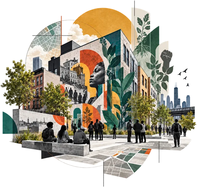
Program 01
Public Art & Urban Activation
Site-specific installations and exhibitions that highlight community narratives, environmental justice, and histories of displacement.
Public projects
Three programs — public art, hyper-localized farming, and education — drawn on one ground, with the instruments they work against cutting across it and the finished work pinned where they meet.

Data · art · architecture
This organization sits where three things meet: the data that proves what was done to a place, the art that makes it visible, and the architecture that did it and can undo it. The three programs are that meeting drawn on the ground. Each is a plot; where two overlap something specific grows; where all three overlap is the method they are held to. Across the plots run the six instruments the methodology studies — the lines that interrupt — and the finished work sits at the points where programs and instruments connect.
The data is the input — what the research starts from: census tables and community health profiles, zoning maps and tax-lien records, community board reports and city budgets, agricultural studies, agency reports, and what neighbors say in surveys and at the table. The work is the processing of that record into tools and programs. The output is what a neighbor would want from it: a block that knows its own story; food grown, owned, and taught on the block; people who can read the city, and change it. The Data lens shows each plot’s sources and its desired outcome; the plot itself is the work between them.
Select a plot, a line, or a marker to read it. Look through a lens to re-weight the drawing.
Where all three meet
Where the three meet is the method they are all held to: dual narrative, documentation, citation, discipline, disclosure. Every installation, bed, and workshop passes through the same five rules before it is released.
Program 01
Site-specific art installations and exhibitions in public space that surface community narratives, environmental justice, and the histories of displacement written into the ground beneath us.
Three installation series
Instruments it works against
Sound & Voice as Spatial Resistance · Housing as Instrument · Infrastructure as Policy · Mobility as Segregation
Program 02
Community-controlled food production woven together with arts-based placemaking — elevated green spaces that double as living canvases for cultural storytelling.
Three practices
Instruments it works against
Food as Empire · Infrastructure as Policy · Sound & Voice as Spatial Resistance · Water as Control
Program 03
Interactive programs that engage local schools and community groups in hands-on design thinking, sustainable material use, and cultural preservation through artistic practice.
Three workshops
Instruments it works against
Food as Empire · Water as Control · Housing as Instrument · Mobility as Segregation · Infrastructure as Policy · Sound & Voice as Spatial Resistance
Where public art and farming meet
A mural on the wall of a garden; a bed planted in the pattern of a lending map. Placemaking that grows, and art that feeds — the elevated green spaces the farming program calls living canvases for cultural storytelling.
Where public art and education meet
A block's history projected onto its own buildings is a lesson taught at the scale of a street. The archival overlays the art program installs are the same documents the education program teaches people to read.
Where farming and education meet
Students co-labor with the gardeners who keep East New York's four community gardens, earn school credit in the beds, and map the shade and the storefronts around them. The harvest is the least of it.
Instrument 1 of 6 · an interruption
How highways, bridges, transit, and utilities encode power into physical systems — engineered landscapes as instruments of governance.
Material networks built to route movement, capital, and risk.
Spatial segregation, movement control, and governance embedded so deeply in the built form that it reads as terrain rather than decision.
Programs that work against it
Public Art & Urban Activation · Hyper-Localized Farming · Workshops & Education
Work on this line
Instrument 2 of 6 · an interruption
Public housing, zoning, Title I clearance, redlining, spatial containment, and the mechanics of displacement.
Zoning codes, clearance programs, and lending maps that assign value by geography.
Displacement, segregation, and policy-driven erasure — built form working as social sorting.
Programs that work against it
Public Art & Urban Activation · Workshops & Education
Work on this line
Instrument 3 of 6 · an interruption
How movement systems enable or restrict access — transit provision, circulation control, and borders enforced through design.
Route planning, highway alignment, and the design of who can pass through where.
Transit deserts, neighborhoods carved by highway, pedestrian suppression, policed circulation.
Programs that work against it
Public Art & Urban Activation · Workshops & Education
Work on this line
Instrument 4 of 6 · an interruption
Supply chains, extraction landscapes, agricultural control, labor systems, and diasporic culinary migration and memory.
Colonial production systems and the labor arrangements that made them profitable.
Nutritional inequity in the present, and cultural diffusion carried by the people who were moved.
Programs that work against it
Hyper-Localized Farming · Workshops & Education
Work on this line
Instrument 5 of 6 · an interruption
Environmental burden, flooding, infrastructure neglect, resource governance, and hydrological infrastructure inequity.
Utility investment decisions and drainage engineering that concentrate risk.
Climate injustice, uneven water access, urban heat, and utility inequity borne by the same neighborhoods each time.
Programs that work against it
Hyper-Localized Farming · Workshops & Education
Work on this line
Instrument 6 of 6 · an interruption
Sound is not background. Sound is infrastructure without walls.
Zoning, redlining, and containment draw lines that sound does not observe.
Music as territorial crossing; spirituals, jazz, hip-hop, and protest chant as spatial disruption; sonic memory held in neighborhoods; ancestral sound as survival infrastructure.
Programs that work against it
Public Art & Urban Activation · Hyper-Localized Farming · Workshops & Education
Work on this line
Live · a connection
Immersive interactive documentary — nonlinear, built on the Klynt platform
A decolonial inquiry into the interplay between land, power, policy, culture, and resistance in the creation of ecologies of knowledge that continue to transform African American urban environments.
What it carries · from the record
9 parts · 3 historical excavations
Connects
Public Art & Urban Activation · Workshops & Education
Live · a connection
Video experience
The past never really leaves us. It pulses beneath our present, not just as a memory but as a force that shapes who we are today. Themes of struggle, identity, and resilience are carried forward across generations, creating a continuous narrative that refuses to be silenced.
What it carries · from the record
blues → jazz → hip-hop
Connects
Public Art & Urban Activation · Workshops & Education
Published · a connection
ArcGIS StoryMap
Brooklyn stands at the epicenter of urban displacement, gentrification, and state-sanctioned land dispossession in New York City. This project investigates how Brooklyn, more than any other borough, became the testing ground for development strategies that devalue Black life and extract Black wealth under the guise of progress.
What it carries · from the record
7 decades · 3 neighborhoods
Connects
Workshops & Education · Public Art & Urban Activation
In development · a connection
Character compendium — 64 Food Guardians across 8 world regions
Demystifying Food Origins uses character design, agricultural history, and regional storytelling to reconnect fruits, vegetables, grains, roots, and tree crops to the people and places that sustained them. It treats food as cultural evidence while distinguishing botanical origin, cultural anchor, crop movement, and artistic interpretation.
What it carries · from the record
64 Guardians · 8 regions
Connects
Hyper-Localized Farming · Workshops & Education
Published · a connection
Participatory design research — pilot program framework
A pilot program addressing lack of access to healthy foods, green spaces, and vulnerability to heat in New York City’s most affected areas — co-designed with public schools, students and faculty, community gardens, private businesses, and municipal organizations.
What it carries · from the record
135 bodegas · 13 grocery stores · 43,025 sq ft of gardens
Connects
Hyper-Localized Farming · Workshops & Education
Plots · three programs
Lines · six instruments
Markers · five works
Source RIP Comprehensive Governance & Internal Methodology Manual v1.3.1; the five works in the register The instruments are the six thematic pillars; the counts at each marker are quoted from that work's own record
The three programs
Site-specific installations and exhibitions that highlight community narratives, environmental justice, and histories of displacement.
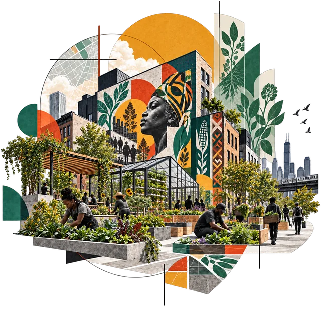
Arts-based placemaking inside community-controlled food production — elevated green spaces as living canvases for cultural storytelling.
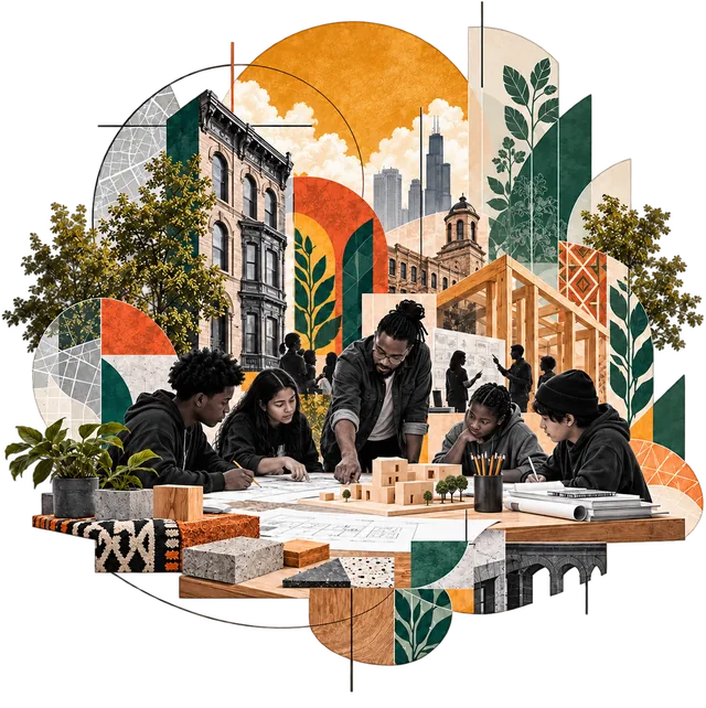
Hands-on design thinking, sustainable material use, and cultural preservation with local schools and community groups.
The intellectual and critical design project — essays, digital works, and the governance framework behind everything.